10 March 2026
11:00 AM EST / 4:00 PM CET
SANDRO ARMANDA
KU Leuven
Respondent: Javairia Shahid, Columbia University
![]() The
Wringin Anom Sugar Factory hidden behind the dense sugarcane field. Photo by
Sandro Armanda, 2025.
***
FEYZA DALOGLU
METU, Middle East Technical University
Respondent: Sara Frikech, ETH Zurich
![]() Plan of the Executed Canal Project of 1851 and the Proposed
Expansion Plan for İskenderun. The National Archives (TNA), FO 195/302, no. 6.
11:00 AM EST / 4:00 PM CET
Ashes to Ashes: Reading the Ruins of the Dutch Colonial Sugar Industry in Postcolonial Java
SANDRO ARMANDA
KU Leuven
Respondent: Javairia Shahid, Columbia University
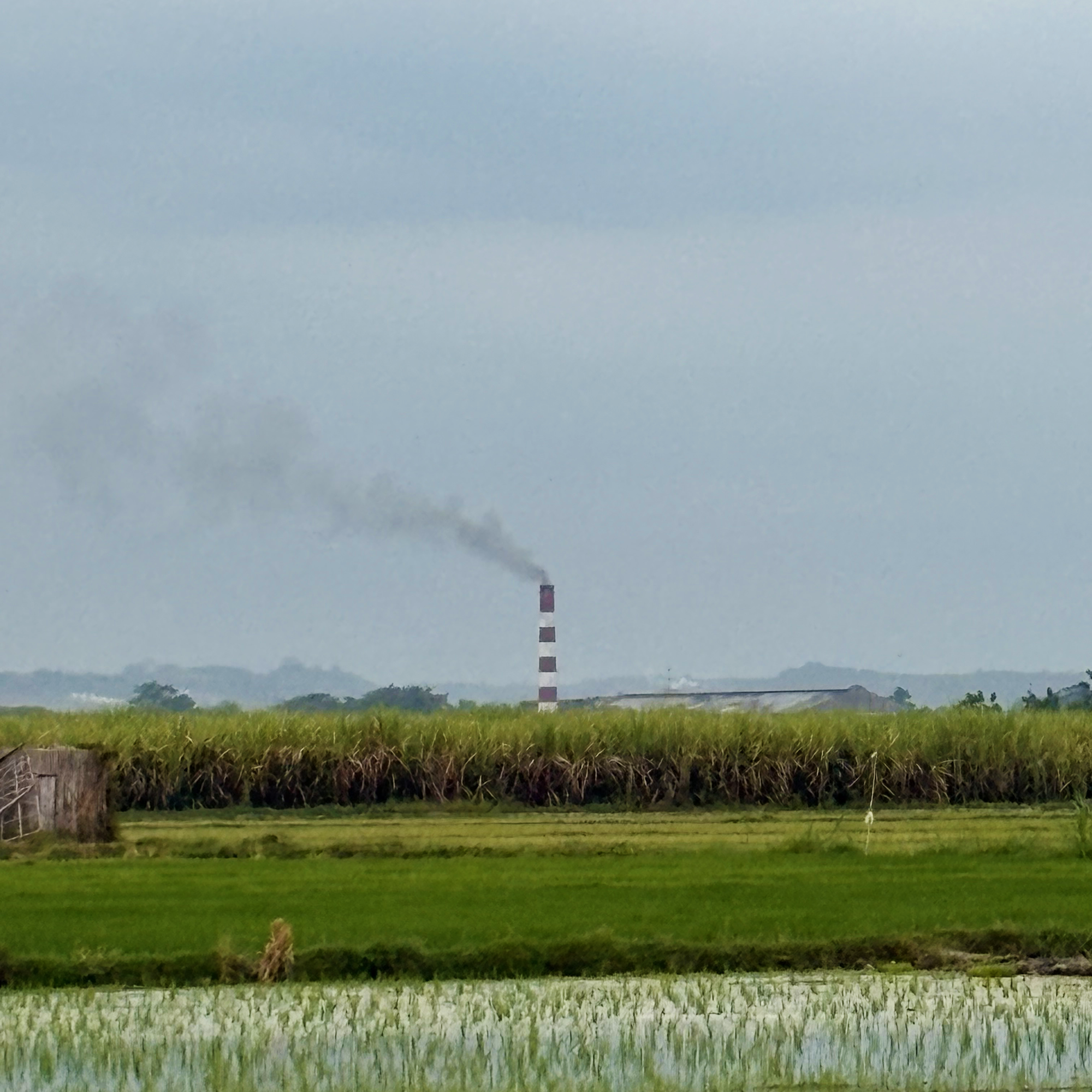 The
Wringin Anom Sugar Factory hidden behind the dense sugarcane field. Photo by
Sandro Armanda, 2025.
The Wringin Anom Sugar Factory is one of the few remaining nineteenth-century sugar factories still operating in Java today. Originally built by a British sugar manufacturer in 1845, the factory compound once functioned not only as a centre of sugar production but also as a tool of colonial control over the
surrounding population and plantation landscape. Today, the site is on the verge of ruin.
Java’s colonial sugar industry began to collapse in the 1930s and was nationalised by the Indonesian state in 1958. Once a leading global exporter of sugar, Java now imports sugar on a massive scale, with Indonesia ranking among the world’s largest importers. The physical infrastructure left behind by thecolonial sugar industry – comprising roads, housing, and plantations – has largely deteriorated, yet it continues to influence rural life and labour today. For instance, the socioeconomic systems and shifts in land ownership that were established during the colonial-industrial era of the nineteenth century continue to exist. Additionally, housing facilities for sugar factory workers, built by sugar manufacturers that introduced modern construction methods, materials, and hygiene standards to the countryside, continue to influence domestic architecture in broader Javanese rural communities today.
In this presentation, I will showcase a work-in-progress paper examining the spatial, architectural, and social legacy of the Dutch colonial sugar industry in postcolonial Java through a case study of the Wringin Anom factory compound – a workers’ village designed around notions of hierarchy, efficiency, and control, which remains inhabited today. Drawing on extensive fieldwork and a lengthy research stay in the factory’s workers’ housing facilities, the paper aims to present the spatial conditions of colonial-era housing in the postcolony. It brings to light how these environments reflect and reinforce labour hierarchies, shaping the lives and livelihoods of contemporary sugar workers in Java’s rural
landscape.
Java’s colonial sugar industry began to collapse in the 1930s and was nationalised by the Indonesian state in 1958. Once a leading global exporter of sugar, Java now imports sugar on a massive scale, with Indonesia ranking among the world’s largest importers. The physical infrastructure left behind by thecolonial sugar industry – comprising roads, housing, and plantations – has largely deteriorated, yet it continues to influence rural life and labour today. For instance, the socioeconomic systems and shifts in land ownership that were established during the colonial-industrial era of the nineteenth century continue to exist. Additionally, housing facilities for sugar factory workers, built by sugar manufacturers that introduced modern construction methods, materials, and hygiene standards to the countryside, continue to influence domestic architecture in broader Javanese rural communities today.
In this presentation, I will showcase a work-in-progress paper examining the spatial, architectural, and social legacy of the Dutch colonial sugar industry in postcolonial Java through a case study of the Wringin Anom factory compound – a workers’ village designed around notions of hierarchy, efficiency, and control, which remains inhabited today. Drawing on extensive fieldwork and a lengthy research stay in the factory’s workers’ housing facilities, the paper aims to present the spatial conditions of colonial-era housing in the postcolony. It brings to light how these environments reflect and reinforce labour hierarchies, shaping the lives and livelihoods of contemporary sugar workers in Java’s rural
landscape.
***
Global Ambitions, Planetary Forces: Drainage, Urban Planning, and the Making of Iskenderun, 1851
FEYZA DALOGLU
METU, Middle East Technical University
Respondent: Sara Frikech, ETH Zurich
 Plan of the Executed Canal Project of 1851 and the Proposed
Expansion Plan for İskenderun. The National Archives (TNA), FO 195/302, no. 6.
In 1851, the third failed canal project of Iskenderun, designed to drain its centuries-old marshes, was laid out and executed by the Hungarian engineer General Maximilian Stein, who served in the Ottoman army as Ferhat Pasha after fleeing the Habsburg Empire. A former Minister of War and Governor of Transylvania, Ferhat Pasha, also prepared Iskenderun’s first urban plan. Though the canal later overflooded and the urban plan was never implemented, both projects reveal the tension between planetary processes and global pressures which would define the making of mid-19th century Iskenderun.
Iskenderun was founded on land formed by sediments carried by the sea and by streams descending from the Amanus Mountains. These geological processes produced extensive marshes and continually pushed the coastline seaward. While these planetary processes sustained a dynamic marsh ecology that actively constrained human habitation, they also created a naturally sheltered anchorage that attracted maritime interest. Fueled by expanding international trade, British efforts to establish faster communication routes to India, and Ottoman ambitions to civilize both land and population, Iskenderun was repeatedly subjected to drainage schemes under global pressure across the nineteenth and early twentieth centuries and was gradually forced into being a town despite persistent environmental resistance.
This article maps out physical imprints of the 1851 canal project on Iskenderun’s land, as well as the gradual growth of the town’s built environment and its population in the 1850s. While doing so it also seeks to trace the global and empire-wide dynamics that forced Iskenderun into being.
Iskenderun was founded on land formed by sediments carried by the sea and by streams descending from the Amanus Mountains. These geological processes produced extensive marshes and continually pushed the coastline seaward. While these planetary processes sustained a dynamic marsh ecology that actively constrained human habitation, they also created a naturally sheltered anchorage that attracted maritime interest. Fueled by expanding international trade, British efforts to establish faster communication routes to India, and Ottoman ambitions to civilize both land and population, Iskenderun was repeatedly subjected to drainage schemes under global pressure across the nineteenth and early twentieth centuries and was gradually forced into being a town despite persistent environmental resistance.
This article maps out physical imprints of the 1851 canal project on Iskenderun’s land, as well as the gradual growth of the town’s built environment and its population in the 1850s. While doing so it also seeks to trace the global and empire-wide dynamics that forced Iskenderun into being.